
Continue Reading
Subscribe for full unlimited access, log in to your account, or create a free account for complimentary articles.

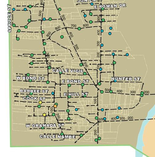
(Courtesy map) This city of Española map shows the affected areas on the west side. The colored dots are fire hydrants and the black-dashed lines are water lines. Most likely the areas affected will be from West Bond Street, south (down) and east (right) to Oñate except for the southern (lower) edge which will extend along Chavez street east (right) to the Oñate Street Bridge.
Lorem ipsum dolor sit amet, consectetur adipiscing elit. Sed do eiusmod tempor incididunt ut labore et dolore magna aliqua.
Ut enim ad minim veniam, quis nostrud exercitation ullamco laboris nisi ut aliquip ex ea commodo consequat.
Subscribe for full unlimited access, log in to your account, or create a free account for complimentary articles.
Copyright © 2026 El Rito Media, LLC. All rights reserved.
Access your digital subscription
Don't have a subscription? Subscribe now →
Create a free account to read complimentary articles, or log in if you already have one.
Want full access? View subscription plans →
Want full access? View subscription plans →
Your free account has been created.